Creator Record
Metadata
Name |
Beaudoin, Arthur |
Related Records
-
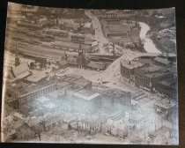
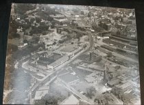
2008.057.001 - print, photographic
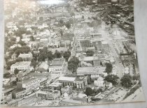
Aerial View of Fitchburg. St. Bernard's Cemetery in right foreground - Fitchburg Gas Works in center.
Record Type: Photo
-
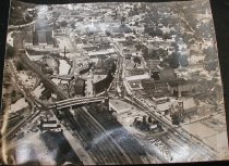
2008.057.002 - print, photographic
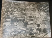
Aerial View of Center of Fitchburg looking East, with Main Street at center.
Record Type: Photo
-
-
-
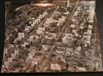
2008.057.005 - print, photographic
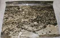
Aerial View of College Neighborhood south of the college. 3 main streets shown are Myrtle Ave., Highland Ave., and Cedar Streets
Record Type: Photo
-
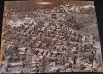
2008.057.006 - print, photographic
Aerial View of Lower South Side on East side of Rollstone Hill with Laurel Hill Cemetery at right.
Record Type: Photo
-
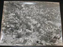
2008.057.007 - print, photographic
Aerial View of Upper Common, Prospect Street, Mechanic Street area
Record Type: Photo
-
2008.057.008 - print, photographic
Aerial View of Water St. Foundry area (Where Shopping Center is now) & Pelletier's Building across the street
Record Type: Photo

-
2008.057.009 - print, photographic
Aerial View of Nashua River and Water St. at Center. Water Street Foundry area
Record Type: Photo
-
2008.057.010 - print, photographic
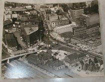
Aerial View of Lower Main Street and Depot Square area
Record Type: Photo
-
2008.057.011 - print, photographic
Aerial View of Burbank Hospital Campus ca. 1950
Record Type: Photo

-
2008.057.012 - print, photographic
Aerial View of Main Street and Central part of the city.
Record Type: Photo